Re: 40 Stunning Images Of Our Planet By NASA
Posted: Tue Jan 30, 2018 12:51 pm
3. Eastern Seaboard at Night
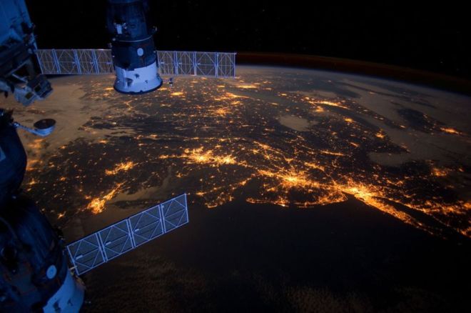
An Expedition 30 crew member aboard the International Space Station took this nighttime photograph of much of the Atlantic coast of the United States. Large metropolitan areas and other easily recognizable sites from the Virginia/Maryland/Washington, D.C. area are visible in the image that spans almost to Rhode Island. Boston is just out of frame at right. Long Island and the New York City area are visible in the lower right quadrant. Philadelphia and Pittsburgh are near the center. Parts of two Russian vehicles parked at the orbital outpost are seen in left foreground.
4. Alaska’s Brooks Range
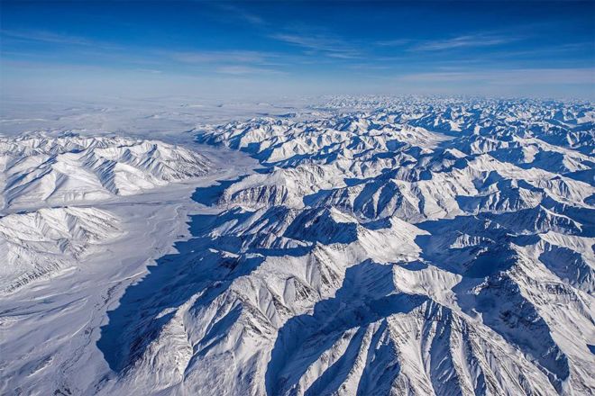
NASA’s Operation IceBridge images Earth's polar ice in unprecedented detail to better understand processes that connect the polar regions with the global climate system. IceBridge utilizes a highly specialized fleet of research aircraft and the most sophisticated suite of innovative science instruments ever assembled to characterize annual changes in thickness of sea ice, glaciers, and ice sheets.
Mountains in Alaska’s Brooks Range seen during the IceBridge survey flight from Thule, Greenland to Fairbanks, Alaska.
An Expedition 30 crew member aboard the International Space Station took this nighttime photograph of much of the Atlantic coast of the United States. Large metropolitan areas and other easily recognizable sites from the Virginia/Maryland/Washington, D.C. area are visible in the image that spans almost to Rhode Island. Boston is just out of frame at right. Long Island and the New York City area are visible in the lower right quadrant. Philadelphia and Pittsburgh are near the center. Parts of two Russian vehicles parked at the orbital outpost are seen in left foreground.
4. Alaska’s Brooks Range
NASA’s Operation IceBridge images Earth's polar ice in unprecedented detail to better understand processes that connect the polar regions with the global climate system. IceBridge utilizes a highly specialized fleet of research aircraft and the most sophisticated suite of innovative science instruments ever assembled to characterize annual changes in thickness of sea ice, glaciers, and ice sheets.
Mountains in Alaska’s Brooks Range seen during the IceBridge survey flight from Thule, Greenland to Fairbanks, Alaska.