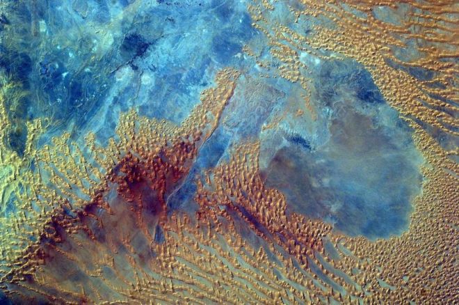
Middle school students programmed a camera aboard the International Space Station -- the Sally Ride EarthKAM -- to photograph this portion of the Sahara desert in western Libya on October 3, 2016. In early November 2016, the Expedition 50 crew set up the EarthKAM gear once again in the Harmony module’s Earth-facing hatch window, to allow students to photograph targets on Earth and downlink the imagery.
EarthKAM is the only program providing students with such direct control of an instrument on a spacecraft orbiting Earth, teaching them about environmental science, geography and space communications. The project was initiated by Dr. Sally Ride, America’s first woman in space, in 1995 and called KidSat; the camera flew on five space shuttle flights before moving to the space station on Expedition 1 in 2001.
38. Cloudscape Over the Philippine Sea
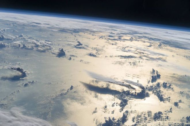
Flying over the Philippine Sea, an astronaut looked toward the horizon from the International Space Station and shot this photograph of three-dimensional clouds, the thin blue envelope of the atmosphere, and the blackness of space. The late afternoon sunlight brightens a broad swath of the sea surface on the right side of the image. In the distance, a wide layer of clouds mostly obscures the northern Philippine islands (top right).
Looking toward the sun to capture an image is a special technique used by astronauts to accentuate the three dimensions of landscapes and cloudscapes through the use of shadows. Two large thunderclouds rise next to one another (lower right). These clouds have long tails, also known as anvils, that stretch nearly 100 kilometers to the south. Anvils form when thunderstorm clouds rise high into the atmosphere and reach a “capping layer” thousands of meters (tens of thousands of feet) above sea level. Capping layers stop the upward growth of a cloud, deflecting air currents horizontally to form anvils.